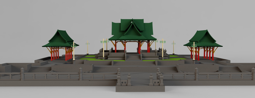
In this example, we will do site survey of a park in Nonthaburi. This park sits alongside Chao Phraya River. It has an interesting landscape, multilevel floors and steps.
The suspension bridge seen far away is Chesadabodin Bridge. This area always floods during monsoon season. It has been built for quite some time and floor structure starts to deflect and cause water pounding as you will see from the survey result.
The photos above are the point cloud data retrieve from the scanner. Total scan area is 4,000 m2 and it only take a while to complete. If we do this survey conventionally with a Total Station, this will take days to complete, and the detail captured is non-comparable to the scanner.
We walk and scan for a distant or 240 meters, usually LiDAR scanner will drift with long straight path like this, but we hook the scanner to RTK GNSS Receiver for correcting error and keep it within 15mm from start to end. There're over 24 million points captured. Next process, we'll turn this point cloud into a very useful CAD drawings.
Many CAD and 3D software are now can import point cloud for reference when creating model, such as SketchUp, Revit and AutoCAD. But this is time consuming. We use special software with AI assisted to match plane to walls, floors and create object directly from selected point cloud. Our delivery rate is 1,000 m2/day.
From site survey to complete drawings will take 4 days to complete for both 3D and 2D CAD drawings. All corners, wall, floors, steps, large trees are presented in the drawing with survey grade accuracy. Reedy to be used for Architects and Landscape designer for renovation design. Work and surface area can also be calculated for the contractor estimation. We can also provide GPS coordinate for a certain point for construction reference.

Plan, elevation and sections drawings are auto generated into DWG files and can be edit, view and give dimensions in AutoCAD or compatible software.
Besides 2D CAD drawings, we also provide 3D file in 6 formats so you can use it in most 3D applications without any effort.
OBJ - Blender
SAT - Revit
DWG - AutoCAD, Revit, Sketchup
MAX - 3DsMAX
3DS - Sketchup
IGS - Solid Works, Solid Edges
The sample files can be downloaded here for your review.
Promotion Price - Until FEB 2024
First 50 sq.m - 6,000 THB*
Above from 50 sq.m - 15 THB/m2*
eg. 35 m2 condominium room costs, 6,000 THB
200 m2 house costs 6,000 + 150 x 15 = 8,250 THB
4,000 m2 shopping mall 6,000 + 3500 x 15 = 58,500 THB
* Price excludes VAT and travelling fee.
For Scanner machine please contact https://store.fjdynamics.com/products/fjd-trion-s1-3d-lidar-scanner


Comments